Instrument: VIS/NIR Sensor
Center coordinates: lat. 45.45, long. 12.38
Image Credit: European Space Imaging (EUSI)
Acquistion: June 22, 2008
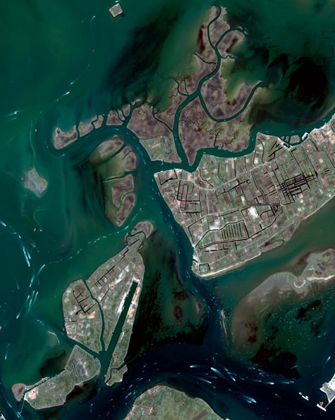
Venetian Lagoon
This Ikonos-2 image captures the busy waterways of the Venetian Lagoon and the islands located northeast of the city of Venice (not visible).
The Venetian Lagoon, a crescent-shaped body of water between the Italian mainland and the Adriatic Sea, covers 550 sq km and has an average depth of approximately one meter. The lagoon and Venice were declared a UNESCO World Heritage Site in 1987.
The lagoon's largest island is Saint Erasmus (center right). Saint Erasmus and its neighboring island Le Vignole (bottom left) have long been referred to as Venice's countryside because they are covered in fields, groves and vineyards.
Le Vignole once functioned as a market garden for Venice, which is located west of Le Vignole.
The
lagoon's labyrinth of waterways is made visible by boats and their contrails.
The shallowness of the lagoon makes it essential to travel in navigation
channels to avoid sandbanks and mudflats.
Related
image: City
of Venice
Click Here