ImageCredit: ESA
Release Date: May 22, 2009
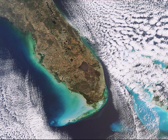
Florida, USA
This Envisat image features the southern tip of Florida, located in the southeast region of the United States. The peninsula juts outs into the Atlantic Ocean (right) and the Gulf of Mexico for more than 550 km. The brown circular area is Lake Okeechobee, the third largest freshwater lake contained entirely within the country. Located southeast of Lake Okeechobee is the Arthur R. Marshall Loxahatchee National Wildlife Refuge (dark brown, tear-drop shape). Miami is visible in pale green just beneath the National Wildlife Refuge on the coast, while the city of Orlando can be seen in pale green just inland from the Atlantic Ocean coastline above Lake Okeechobee.
Click Here